Chiavenna
This article is about the Italian municipality. For the astronomer, see Paolo Chiavenna.
| Chiavenna | |
|---|---|
| — Comune — | |
| Comune di Chiavenna | |
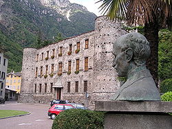
| The castle | |
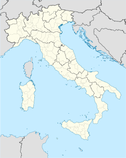
| Location of Chiavenna in Italy | |
| Coordinates: 46°19′N 9°24′E / 46.317°N 9.4°ECoordinates: 46°19′N 9°24′E / 46.317°N 9.4°E | |
| Country | Italy |
| Region | Lombardy |
| Province | Province of Sondrio (SO) |
| Frazioni | Campedello, Loreto, Pianazzola, San Carlo |
| Area | |
| - Total | 11.1 km2 (4.3 sq mi) |
| Elevation | 333 m (1,093 ft) |
| Population (Dec. 2004) | |
| - Total | 7,263 |
| - Density | 654.3/km2 (1,694.7/sq mi) |
| Demonym | Chiavennaschi |
| Time zone | CET (UTC+1) |
| - Summer (DST) | CEST (UTC+2) |
| Postal code | 23022 |
| Dialing code | 0343 |
| Website | Official website |
Chiavenna (Latin: Clavenna, Italian: Chiavenna, German: Cläven or Kleven, Romansh: Clavenna) is a comune (municipality) in the Province of Sondrio in the Italian region Lombardy, located about 100 km north of Milan and about 40 km northwest of Sondrio. As of 31 December 2004, it had a population of 7,263 and an area of 11.1 km².[1]
The municipality of Chiavenna contains the frazioni (subdivisions, mainly villages and hamlets) Campedello, Loreto, Pianazzola, and San Carlo.
Chiavenna borders the following municipalities: Mese, Piuro, Prata Camportaccio, San Giacomo Filippo.
Location and history
Chiavenna, the Roman Clavenna, was a town of Rhaetia, on the Italian side of the Alps, about 16 km from the head of the Lacus Larius (modern Lake Como), at the foot of the Valle Spluga which leads up to the Splügen Pass. The Itineraries demonstrate that the pass was frequented in ancient times; as well as another, which separated from it at Clavenna, and led by a more circuitous route over to Curia (modern Chur), where it rejoined the preceding road. (Itin. Ant. pp. 277, 278; Tab. Peut.; P. Diac. vi. 29.) It was by one or other of these passes that Stilicho crossed the Alps in midwinter, a feat celebrated by Claudian (de B. Get. 320-358). After the collapse of the Western Roman Empire the city marked the northern limit of the Ostrogothic Kingdom in Italy. Clavenna was retaken by the Romans in the mid 6th century during the reign of Justinian and avoided capture by the Lombards until the 7th century. Clavenna probably derived some importance from its position at the junction of these two passes, as does the modern town of Chiavenna, which is the chief town of the surrounding district.
Demographic evolution

References
 This article incorporates text from a publication now in the public domain: Smith, William, ed (1854–57). "article name needed". Dictionary of Greek and Roman Geography. London: John Murray.


