Ottoman Iraq - Wikipedia
From Wikipedia, the free encyclopedia
Ottoman Iraq (Arabic: العراق العثماني) refers to the period of the history of Iraq when the region was ruled by the Ottoman Empire (1534–1920; with an interlude from 1704 to 1831 From Independence under the Mamluk state of Iraq).
Before reforms (1534–1704), Iraq was divided into four Eyalets (provinces):

Ottoman Iraq was later (1831–1920) divided into the three vilayets (provinces):

During World War I, an invasion of the region was undertaken by British Empire forces and was known as the Mesopotamian campaign. Fighting commenced with the Battle of Basra in 1914 and continued for the duration of the war. The most notable action was the siege of Kut, which resulted in the surrender of the British and British Indian Army garrison of the town in April 1916, after a siege of 147 days.[1]
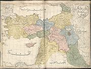
Contemporary maps, showing eyalets (pre Tanzimat reforms)
[edit]
Maps of contemporary Ottoman Iraq showing eyalets (pre 1864 Vilayet law)
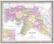
Contemporary maps, showing vilayets (post Tanzimat reforms)
[edit]
Maps of contemporary Ottoman Iraq showing vilayets (post Tanzimat reforms)
-
1855, showing sanjaks
-
1873
-
1893
-
1900 (Stanford), showing vilayets


